Radio + voice
Land mobile, aviation, and team comms.
Explore the platform, source-linked product examples, integration dependencies, and documentation. Existing demonstrations are illustrative; availability requires the appropriate access and configuration.
Explore a workflow with Satchy →Connected field intelligence
TerraSatch brings radio, maps, weather, sensors, and existing tools together. Satchy turns those signals into shared context your team can search, review, and act on.
01 · Sources
Capture approved field communication and environmental data without asking crews to abandon the tools they already carry.
Land mobile, aviation, and team comms.
Forecasts, maps, location, and environment.
Operational feeds and existing software.
Extend to remote and austere locations.

02 · Satchy
Satchy normalizes fragmented signals into shared operational context that your team can search, review, and act from.
Keep source, time, location, and permissions attached.
Normalize signals into shared operational context.
Connect related events, people, places, and workflows.
Keep outputs traceable and human-approved.
03 · Outcomes
Turn field data into actionable outputs that flow to your existing tools, teams, and decision-makers.
Enriched maps and situation layers.
Assignments, follow-up, and team coordination.
Shareable reports, summaries, and data exports.
Send to your existing tools and systems.
Integrations
TerraSatch adapts to your organization. Connect approved data and workflows to the tools you already use.
onX
Backcountry
CalTopo
Gaia GPS
Esri ArcGIS
Mapbox
Google Drive
Microsoft 365
Slack
Snowflake
Custom connectors
Scoped by deployment
Connector availability varies by provider API, permissions, deployment scope, and customer configuration.
Listen · radio as a connected source
TerraListen is one entry point into Satchy. It preserves approved radio and voice communication, keeps the source attached, then connects that record to the rest of the operational picture.
01
Capture authorized radio and voice input without changing how crews already communicate.
02
Create searchable text with source, time, location, and field context preserved.
03
Join the record to maps, weather, terrain, timelines, and the appropriate team workflow.
04
Prepare a shared handoff, task, timeline, or report while keeping the original source available.
Example operational record
A radio report can remain connected to its transcript, extracted observation, location, surrounding data, timeline, and human review instead of disappearing after the call ends.
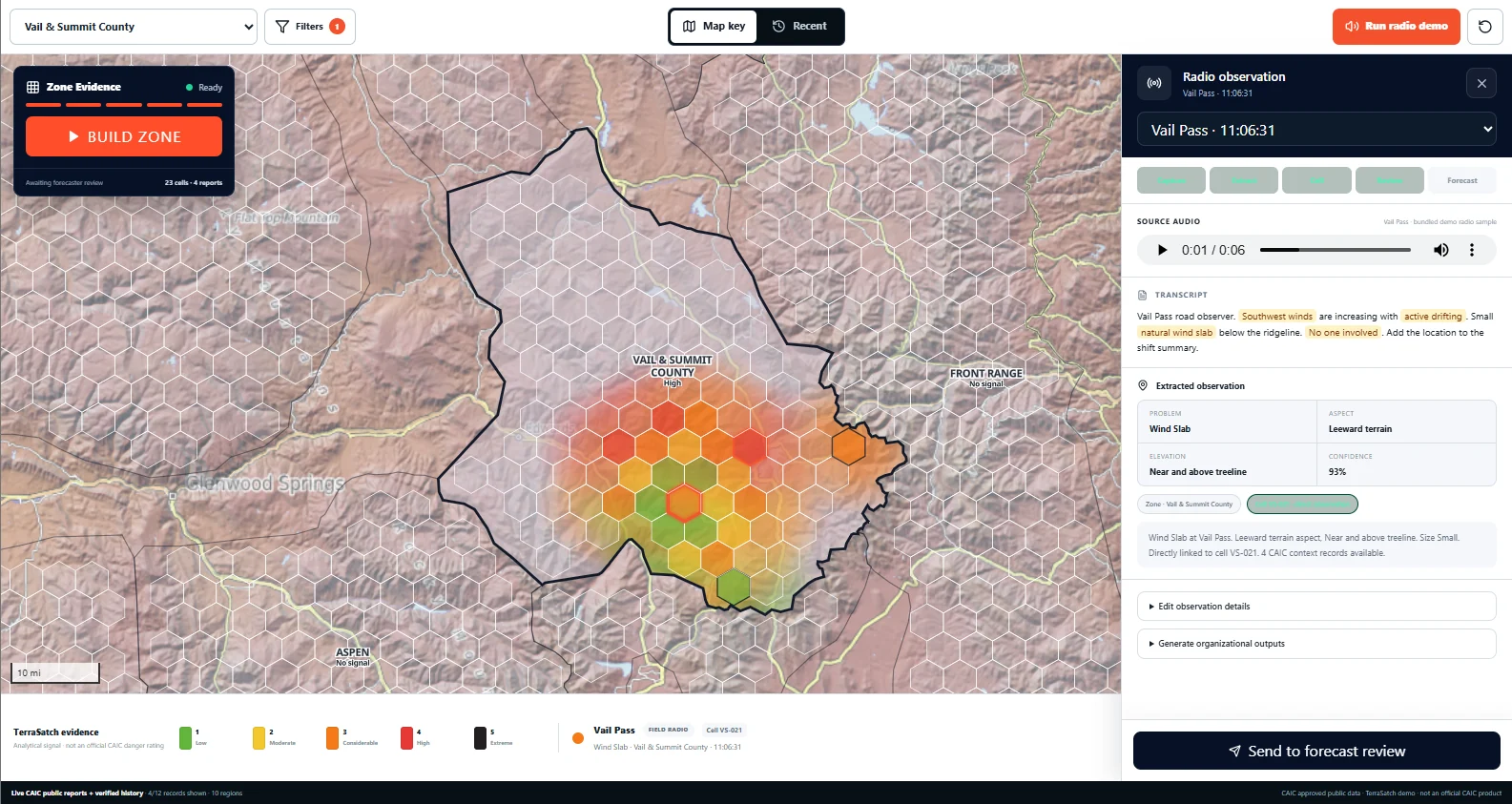
TerraListen + AvyTS · Vail Pass
The original radio report remains available while the structured observation, terrain context, and review handoff stay linked to it. Illustrative product preview.
Watch · terrain context
A field report becomes more useful when the team can see where it happened and what surrounds it. AvyTS connects the report to terrain, weather, forecast zones, and nearby evidence for review.
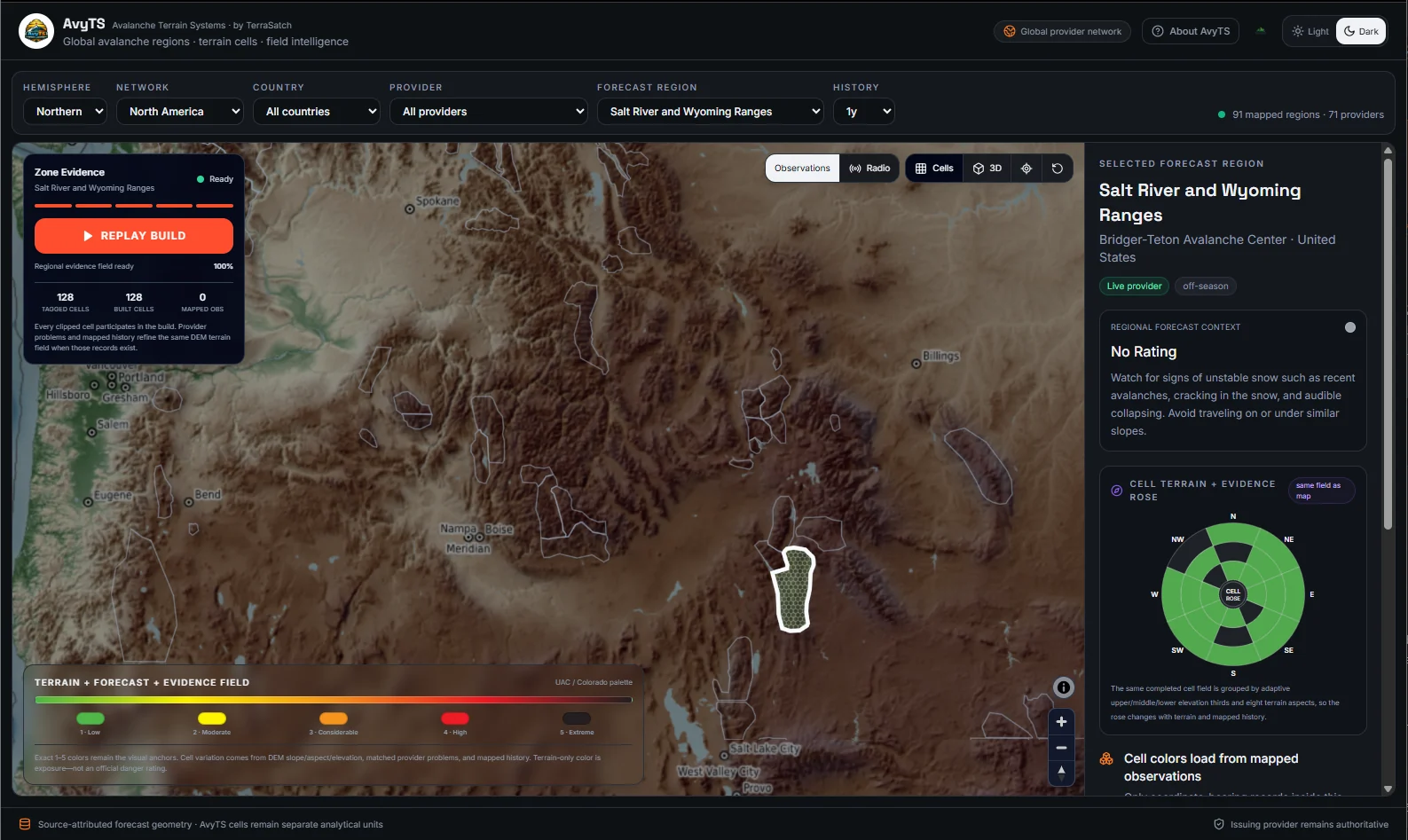
AvyTS · Regional terrain
Reviewers can keep mapped observations, terrain context, provider geometry, and the selected forecast region visible in one operating picture. Illustrative product preview.
The goal is not automated judgment. It is to give the responsible operator better evidence, clearer context, and an easier handoff.
View operational examples01
Use terrain, elevation, aspect, slope, imagery, and repeatable cell context for the place crews are discussing.
02
Snowpits, patrol notes, radio observations, and uncertainty remain connected to the location where they were collected.
03
Weather, forecast zones, wind loading, and published observations help reviewers understand what surrounds the local report.
04
TerraListen and AvyTS can prepare a traceable record, briefing, or follow-up queue. A qualified reviewer remains responsible for guidance and action.
Learn · operational memory
Satchy keeps communication, observations, terrain, weather, documents, and connected operational data linked so useful context does not disappear when the moment, shift, or system changes.
Keep authorized calls, voice, field notes, and structured observations connected to their source and location.
Join terrain cells, weather, approved documents, sensor context, and shift records without flattening them into one opaque answer.
Build a searchable operational history crews can review across a shift, incident, site, or recurring workflow.
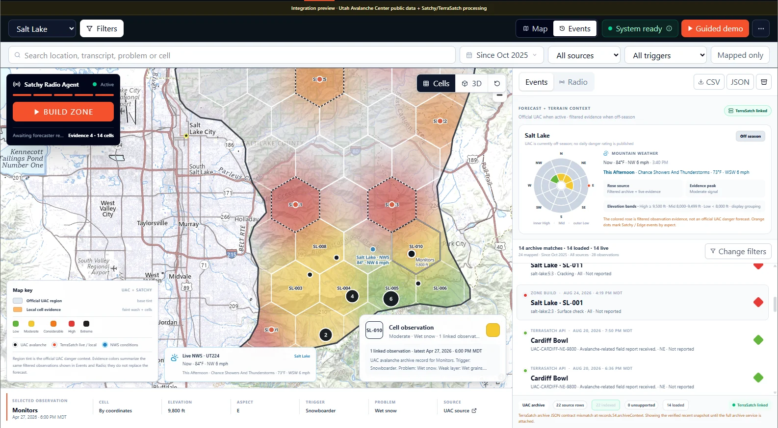
Operational memory · Salt Lake
A selected observation remains connected to its location, terrain details, source, and surrounding context. This is an illustrative integration preview.
Adapt · reviewed outputs
Prepare reviewable briefings, handoffs, reports, and follow-up actions while keeping the responsible operator in control.
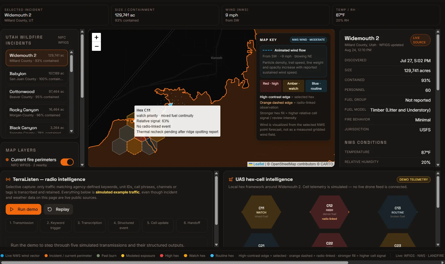
Adapt · Wildfire operations
Incident context, approved communication, weather, and local cells can be assembled into one reviewable operating picture before a team publishes or acts. Demo data is illustrative.
Turn reviewed observations into concise shift or incident briefings with the source record still available underneath.
Prepare reviewable alerts, handoffs, and follow-up queues for the right team without bypassing human approval.
Support reports and operational outputs while keeping qualified operators responsible for what is published or acted on.
Teams · field operations
TerraSatch is being shaped around teams that already depend on communication systems, terrain awareness, field observations, connected data, and human judgment. The goal is to connect that infrastructure, not make crews relearn the field.
Satchy · TerraSatch AI agent
Built for real field crews
Incidents, avalanche observations, handoffs, and daily mountain coordination.
Locations, team updates, and a reviewable incident record under pressure.
Remote crews, asset updates, dispatch, and time-sensitive field records.
Ranger coordination across departments, terrain, and large operating areas.
Does this look relevant to your operation?
Evaluate one real workflow with your team. No software account or production commitment is required.
Current connection surface
TerraSatch now exposes 20 supported third-party provider pathways plus TerraSatch Edge and Mapbox as managed providers. Availability still depends on the credentials, provider access, and administrator configuration for each organization.
Native field inputs
Radio through TerraSatch Edge, signed-in mobile observations, and approved Garmin inReach messages all feed the same canonical field record pipeline.
Managed by TerraSatch
These are part of the TerraSatch-managed platform surface rather than customer OAuth or service-account setup.
Provider access
Garmin inReach Portal Connect is implemented but partner-gated. Outdoor mapping providers remain visible without pretending unsupported public connections exist.
Partner required: Garmin inReach Portal Connect
Coming soon: onX Backcountry, Gaia GPS, AllTrails
“Supported” means TerraSatch has an implemented provider path. It does not mean every provider is already connected inside every customer workspace; OAuth apps, service credentials, webhook destinations, and provider approvals still have to be configured where required.
The radio agent is the front door. The terrain platform remains the long view.
Now
AI radio agent + human-authorized routing
Next
Documents, workflows, and field integrations
Expand
TerraGrid + AvyTS, PyroTS, HydroTS, GeoTS, InfraTS
Future
SherpAI, AR views, and partner APIs
A direct conversation
Have a workflow in mind? Message our team and tell us where work gets repeated.
Current publication · August 2026
The current 31-page TerraSatch whitepaper explains the platform, Satchy agent, TerraListen workflow, Listen · Watch · Learn · Adapt operating loop, terrain modules, architecture, and human-review model.
Current platform architecture, Satchy field-intelligence workflow, TerraListen, domain modules, operational memory, integrations, and human-review boundaries.
v2.0 · August 30, 2026 · 31-page PDF